
West Milford Postal ZIP Coverage
West Milford occupies a large Highlands township in northern Passaic County, so its postal geography is wider and less tidy than a compact town grid. Official records show several postal codes around township addresses. The strongest direct evidence supports 07480 for central West Milford, 07421 for Hewitt and Upper Greenwood Lake context, and 07435 for Newfoundland and the Route 23 vicinity. Two more codes appear only as address-level edge evidence. Each result needs an address check before it is treated as part of the township.
| ZIP | Areas evidenced | Post office evidence | Record caution |
|---|---|---|---|
| 07480 | Central West Milford and municipal mailing addresses | West Milford Post Office, Union Valley Road | Main township ZIP, not a municipal boundary. |
| 07421 | Hewitt, Upper Greenwood Lake, and northern lake-area addresses | Hewitt station on Union Valley Road | A West Milford situs can carry a Hewitt mailing name. |
| 07435 | Newfoundland, Route 23, and Clinton-area vicinity | USPS Newfoundland location result | Not every address using this ZIP is in West Milford. |
| 07438 | Oak Ridge-area edge address | State environmental record | USPS city output was not captured; verify the address. |
| 08848 | Single Route 23 or Clinton-related anomaly | One state environmental record | Not a general West Milford ZIP claim. |
Use the township name, postal city, and ZIP as separate labels in notes. That keeps a mail-routing clue from being mistaken for a town boundary or a resident record.
07480 has the clearest central-township evidence through the West Milford Post Office at 1560 Union Valley Road. USPS material also identifies a Hewitt station at 1926 Union Valley Road for 07421, while its Newfoundland result identifies a Route 23 location for 07435. Those station facts show why a West Milford address can carry a different postal name. They do not make each postal service area identical to the township.
West Milford Postal Address Checks
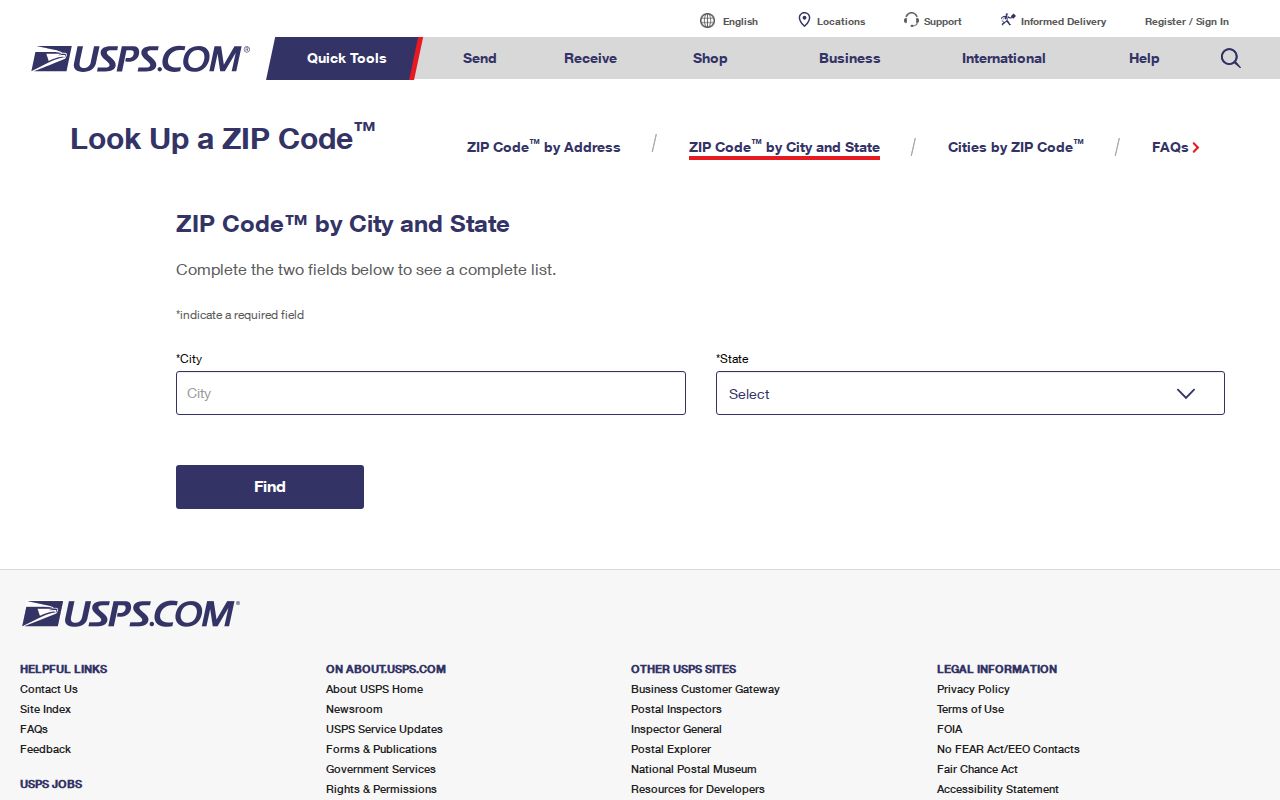
The USPS postal lookup is the final check for a full delivery address. It supports an address or city-and-state route, although the live form labels were not captured during research. Enter the full street address rather than relying on a hamlet name alone. Retain the returned city and ZIP exactly as displayed, then compare them with the property record.
The USPS lookup interface is the official postal starting point for a West Milford postal check.
A postal match confirms delivery formatting. It does not confirm township jurisdiction, parcel identity, ownership, or current occupancy.
Note: A postal city can be useful for mail but still differ from the municipality recorded on a parcel.
West Milford Parcel ZIP Fields
Passaic County's parcel map service carries both postal and property identifiers. Its REST layer can be queried using ZIP-related fields, but the public Property Explorer interface that was inspected offers address, county, municipality, block, and lot rather than a ZIP search mode. For a ZIP-wide working set, use the county data carefully, then verify each address with USPS and the municipal boundary.
| Parcel field | How it helps | Limit |
|---|---|---|
| ZIP_CODE / ZIP5 | Groups parcel records by postal ZIP. | Postal service is not a township border. |
| ZIP_PLUS4 | Adds delivery detail to a matched address. | It does not identify a household. |
| CITY_STATE | Shows the county's mailing or locality display. | Compare it with the situs field. |
| ST_ADDRESS / PROP_LOC | Identifies the property location. | Street wording can vary in old records. |
| MUN_NAME, block, and lot | Anchors a record to a municipality and legal parcel. | Use the full combination, not ZIP alone. |
The Passaic parcel-layer schema also lists owner, deed book, deed page, and deed date fields. Those are property clues, not a resident roll. County GIS says its compiled map data is not a legal survey.
For an alternate local route, the West Milford tax-bill search accepts block and lot, account number, or street address. Its public historical coverage and result fields were not captured, so it should be used to bridge a known address to a legal parcel rather than as a dated resident list. Questions about corrections, tax sales, or older rolls go to the Tax Collector at 973-728-2785.
Note: A parcel ZIP field can sort addresses, but municipality plus block and lot remains the stronger property research key.
Finding Residents by West Milford ZIP
A ZIP can organize address work, but West Milford has no verified public ZIP-wide voter browser and the state Property Explorer lacks a ZIP query mode. Begin with the postal result, use GIS fields to locate parcels, and shift to a name or legal parcel key when the question becomes more specific. The state voter check is person and county oriented; a broader voter-list request follows statutory county procedures and protected-address rules.
- Check the full address with USPS and write down the returned postal city and ZIP.
- Locate the address in the Passaic County parcel service by street, municipality, block, or lot.
- Compare the parcel's ZIP, city-state, situs, and municipality fields before grouping nearby results.
- Use the block and lot or a confirmed name for the County Clerk deed index and any lawful voter-status check.
- Move to a street-level record trail after the postal area is narrowed.
When a ZIP points to a particular road, the West Milford street directory is the better place to follow parcel and address records along that road.
The New Jersey voter registration check accepts a person-oriented search, not a public ZIP browser. For an eligible statutory list request, contact the Passaic County elections division for the current form, format, fee, and delivery route. State law controls list access and excludes protected addresses. An inactive status is not proof that a person left an address.
West Milford ZIP Areas and City Limits
ZIP codes describe delivery geography, not local government borders. A West Milford parcel can appear with a Hewitt, Newfoundland, or Oak Ridge mailing context, while a ZIP can also serve land outside the township. The county parcel map, township tax map, and USPS result answer different parts of the question. Do not replace a municipality field with a postal city simply because it looks more familiar.
- ZIP code
- A postal delivery area used to route mail. It can cross municipal lines.
- ZIP+4
- An added delivery segment that narrows a ZIP to a smaller delivery unit, not a property boundary.
- PO-box ZIP
- A ZIP assigned to post-office box service; it is not evidence that a property uses that location.
- Carrier route
- A mail-delivery sequence within an area. It can help organize mail, but it is not a civic district.
The sequence matters on a road that crosses a township line or uses a hamlet name. USPS answers where mail goes. The county's GIS layers help locate the parcel and display municipal, block, lot, situs, and ZIP data. The official West Milford street map adds road-index context. A recorded deed's legal description can then connect the current parcel to older work without assuming the postal city stayed constant.
West Milford Postal ZIP Edge Cases
The 07438 and 08848 entries deserve especially cautious treatment. A West Milford Township address with 07438 appears in an official environmental record. A single official record uses 08848 for a Route 23 or Clinton-related address. Neither finding establishes a township-wide service area. Search the complete address through USPS and preserve the source record's wording in any family or property notes.
No official ZIP split, realignment, or township-wide readdressing history was located. It is safer to document the current address result than to infer when an old ZIP or postal city changed.
West Milford's dispersed roads make that restraint practical. Union Valley Road, Macopin Road, Clinton Road, Warwick Turnpike, Route 23, Oak Ridge roads, and lake-area streets appear in the official road index. Locality terms such as Hewitt, Newfoundland, Upper Greenwood Lake, Macopin, and Oak Ridge can be useful alternate searches, but none should be silently converted into a separate municipality without the parcel or municipal record to support it.
Note: Record the displayed postal city and source date when an unusual ZIP appears in a historical address trail.
West Milford Postal ZIP Geography
West Milford's size helps explain these mismatches. Census QuickFacts reports 75.93 square miles of land in 2020 and 24,862 residents that year, with a 2025 estimate of 25,216. Roads, lakes, and hamlet names spread across that landscape. A parcel PIN, block and lot, and complete street address remain steadier research keys than a postal name by itself.
Note: The census figures describe township scale, not the number of people or parcels within any ZIP code.
Limits of a West Milford ZIP Code Directory
A ZIP code directory can help sort addresses, not identify every person connected with one. Utility customers, DMV records, household members, and protected addresses are not public postal lists. New Jersey's voter tools have their own access rules, and Daniel's Law can remove protected home addresses from public government records. A blank result can reflect a protection or an address mismatch rather than a mistake.
Use address and parcel information for lawful personal research, family history, or property curiosity. Keep a source note for the USPS result, parcel layer, and deed or voter record used. Do not use it to stalk, harass, or harm anyone.